
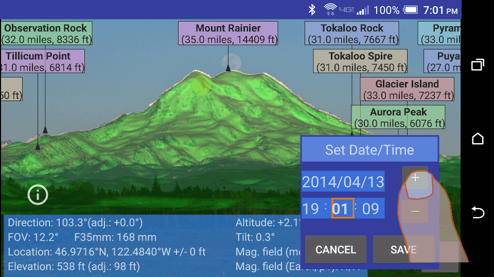
 Set date/time
Tapping  (or selecting it from the menu
![]() )
shows a dialog for setting the date and time
of the current view:
)
shows a dialog for setting the date and time
of the current view:
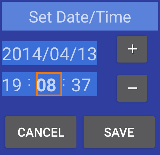
The date/time dialog can be placed anywhere on the screen by touching the title (Set Date/Time), holding it and dragging to the desired position.
Any of the shown fields (year, month, day, or
hour. minute, second) can be changed by first
tapping that field and then incrementing or
decrementing the value of that field by
tapping the plus ( )
or minus (
)
or minus ( )
buttons, respectively. The field selected for change is displayed in bold.
)
buttons, respectively. The field selected for change is displayed in bold.
The main use of the date/time dialog is to visualize the location of the moon (or the sun) at a particular date and time. This should help a photographer plan where and when to locate their camera to capture the moon rising (or setting) behind a particular peak.
The animation below shows an example of using the date/time dialog to show the position of the moon rising above Mount Rainier.
 Terrain off
Turn off terrain display.
 Terrain on
Turn on terrain display.
 Take picture
Take a camera picture. The picture is saved in external SD storage in the directory Pictures.
 Camera preview
Turn on the live camera preview.
 Load photo
With PeakIdentify you can label peaks in photos accessible from your device. Selecting this item from the menu (or tapping the corresponding icon in the toolbar, if shown) will show a list of locations from which you can select a photo. PeakIdentify will label the peaks in view at the GPS location embedded in the EXIF data in the photo. If the photo does not have a GPS location embedded in it, PeakIdentify will use the current location. However, if you know the location at which the photo is taken, you can use the Map view to change the current location to the correct one.
PeakIdentify will also determine the field of view of the shot based on the focal length, the camera model and/or the equivalent 35 mm film focal length, if this information is embedded in the EXIF data of the image file. If this information is not present, or if the photo has been cropped, then PeakIdentify will not be able to calculate the correct field of view. In that case the field of view has to be adjusted manually, as described in Adjusting the Field of View (FOV).
When the photograph is loaded, PeakIdentify will try to automatically find the direction the camera was pointing when the photograph was taken, as described under Automatic View Direction.
 Save labels
Save the current photo with peak labels to the directory LabelledPeaks
 Adjust view
Adjust the view as described in Adjusting View Direction.
 Map view